« Lenten beginnings | Main | The Old Naval Cemetry at Port Royal »
February 26, 2007
Historic Jamaica
The oldest part of the English settlement on Jamaica is Port Royal which lies at the end of the long sandspit that forms the protective break water enclosing Kingston Harbour. Port Rpyal has a long a violent history, having been first established as a base for pirates and slave traders following the displacement of the Spanish. Captain Henry Morgan was based here, one of the most violent and unpleasant characters one could wish to meet (or NOT meet for preference.). Having read a little about the man and his activities there is little doubt in my mind that he fits the classic profile of a psychopath. One substantiated story concerning the behaviour of the men who built this place recounts how a group had observed a woman in the last stages of pregnancy from their favourite drinking den and made a bet as to which sex the child she was carrying would be at birth. Not prepared to wait for nature to provide the answer, one of the number drew his sword and cut her open in the street to find out.
It is probably small wonder, with genetic material like that in the population, that violence is endemic.

The plan of Port Royal as it was in its heyday around 1690. A violent earthquake a few years later saw the whole of the waterfront along the lower side of this plan (the North) sink into the sea.
The settlement was protected by fortifications from assault from the sea and from the land. Fort Charles, the largest of these and the Headquarters of the garrison still remains, its bastions now some distance from the waterfront on the Southern and seaward side. Once the pirates and their supporters were dislodged from the area following the earthquake, the Royal Navy took ovver and established a base here. Sadly many of the original buildings that would have been familiar to Rodney, Hawke and many other famous seamen (and many more not so famous!) are now being allowed to fall apart even though some of them are still in use by the Jamaican Coastguard.
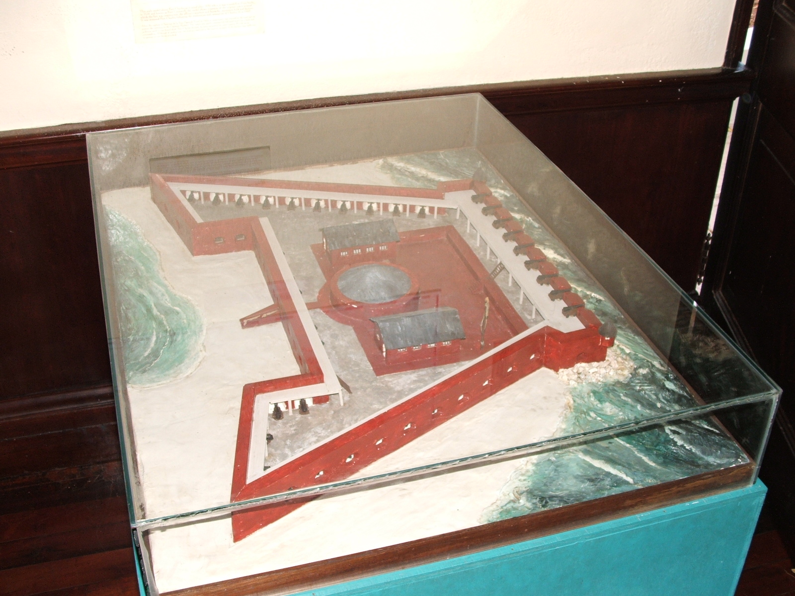
A model of Fort Charles as it was in the early 1700's.
While Fort Charles is the only one of the three forts that is preserved, the ruins of the one that guarded the land approach are still visible on the seaward side of the road approaching the town. The town itself has shrunk as evidenced by reference to the plan shown here and the fact that the Land Guard fort is now some distance from the remaining settlement.
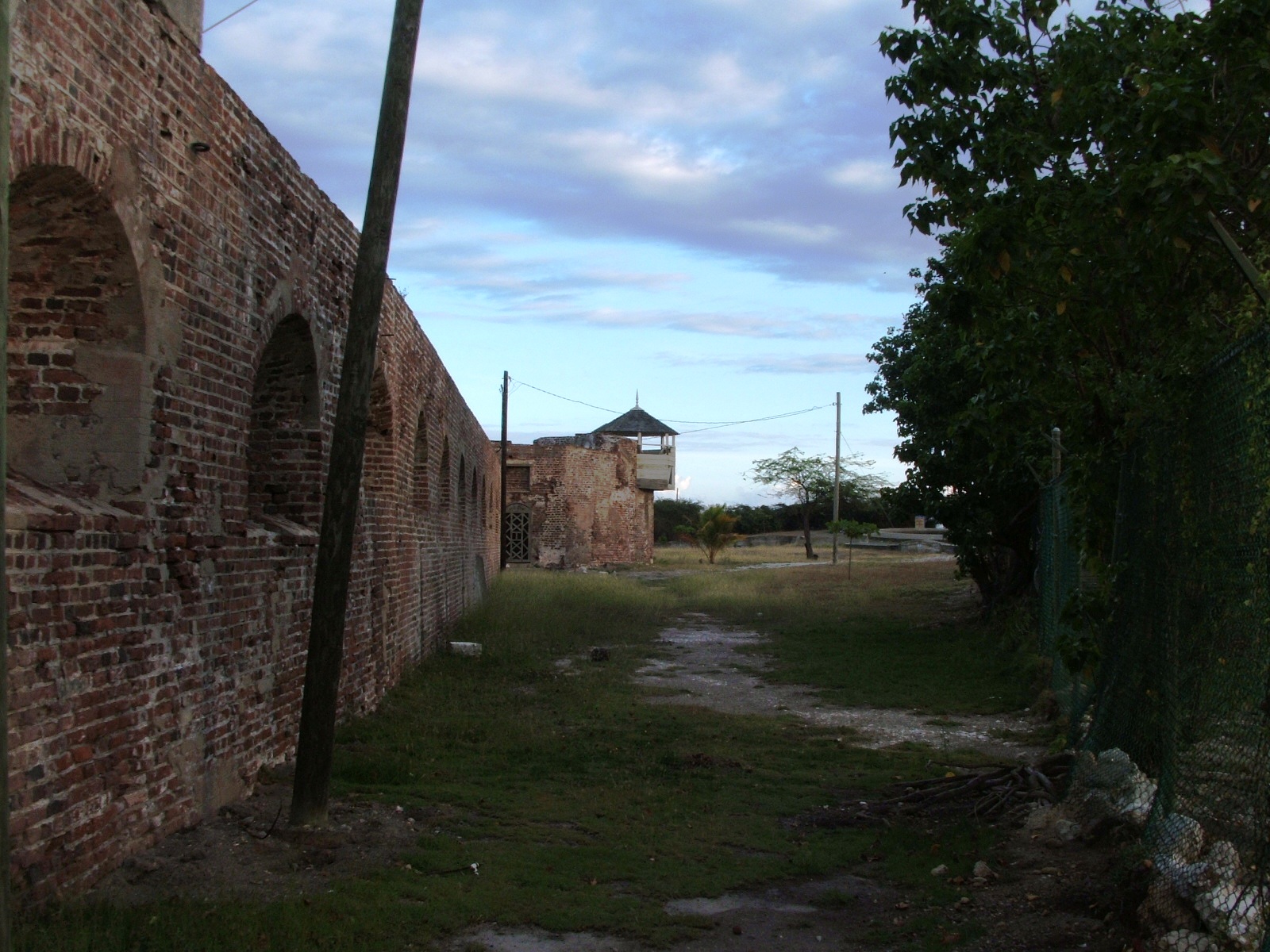
The outer wall of the Western Bastion of Fort Charles. This was once on the sea's edge.
There are signs that something is being done to preserve their heritage - and it is as much the heritage of the modern Jamaicans as it is ours - and some of the buildings that are still saveable are apparently being preserved. The Coastguard has just taken delivery of three very modern and fast strike craft to be used against the drug and gun runners who infest these waters and it is to be hoped that they will make a difference.
Posted by The Gray Monk at February 26, 2007 07:05 AM
Trackback Pings
TrackBack URL for this entry:
http://mt3.mu.nu/mt/mt-tb.cgi/4939