« Nice for some..... | Main | Immigration charades »
December 08, 2005
Once there was sea ....
Along the Eastern shore of Manama there are a number of huge land reclamation projects in progress. In fact the whole of the area which is now covered by new development was once under the sea, and the shore line is being extended by a further half mile to a mile to the East. The original "Gate of Bahrain" which once stood on the shore, is now about a half mile from the sea and this will no doubt continue as the Kingdom's economy expands and the demand for "sea shore" locations continues to grow.
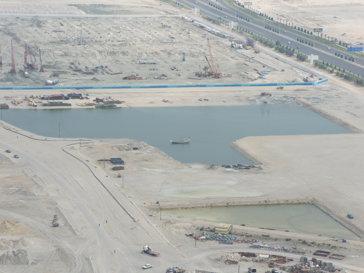
Taken from the top of a newly completed 43 storey tower's helipad, the scene shows the reclamation works which have left an abandoned dhow nearly 500 metres inland in her own shrinking "lake".
The dhow in the picture above, long abandoned and now marooned a long way from any sea access by reclamation work, will be recovered in due course and mounted as a preserved "decoration" when the "lake" she is currently in is finally filled in. This entire area will eventually be covered by high rise blocks and landscaped gardens as the mega-rich move to newly completed apartments, offices and marinas which are slowly rising from these newly created lands.
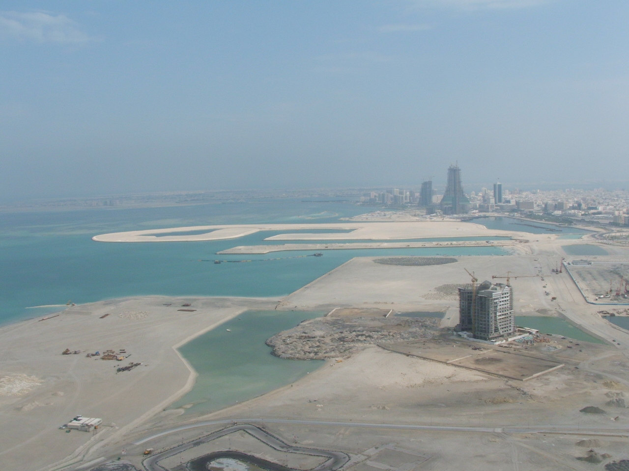
To the left of the last picture, the extent of the reclamation can be seen, with the first of a number of luxury tower blocks rising in the foreground.
A considerable amount of money, time and effort has gone into studying the effects of the reclamation work along this shore and its impact on the environment. The open channles which will eventually criss-cross it are all designed to allow the free flow of tidal movement and ensure that silting is minimal, but already there is an unforseen impact further offshore as the outlying reefs are showing signs of silting, assumed to be the result of offshore dredging. Further studies have shown that this tends to reverse once dredging stops, so perhaps the damage will not be longterm.
Bahrain has considerable experience of this sort of work, as the nations pride is that it has linked itself to the Arabian shore by means of a 25 kilometre long causeway and two artificial islands to Saudi Arabia. This feat of engineering was achieved in the 1980's, again with considerable study of the hydrographic effects it would have and has, thus far, had only a minimal impact on the ocean it traverses. The tides flow freely, thanks to the long bridge spans, and the fish stocks, shell fish and other reef life has seen improvement thanks to a large conservation effort and investment.
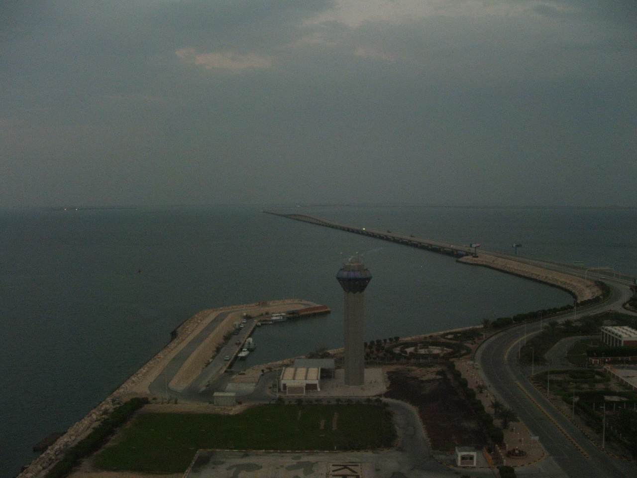
The causeway between Bahrain and Saudi stretches across the intervening sea. This picture was taken from the observation tower on the artificial island created at the midway point between the two nations and shows the Bahraini side.
Perhaps, after all, the reclamation, can be positive for the environment, certainly, talking to those involved in this work, the knowledge gained in each of the studies and in the actual project itself is teaching us more and more about the environment and the forces which affect it.
Posted by The Gray Monk at December 8, 2005 10:59 AM
Trackback Pings
TrackBack URL for this entry:
http://mt3.mu.nu/mt/mt-tb.cgi/3499